Why?
Because of the utter stupidity of the masses. The totally CRAZY videos we are all subjected to. The “theories”/”speculations”/”computer-generated BS”/Entrenched Minds/Over-Complicated Calculations/Mirrors/And now REFLECTIONS off the MOON!
FFS! IT IS A BALL. One half solid. One half not.
As Above, So Below
Put water on a Flat surface and it runs everywhere. Put a barrier around water on a Flat surface and you get no depth…NO OCEANS!!!
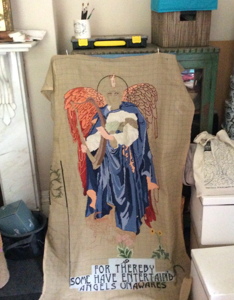
Have you ever worked a tapestry? Well. You have a flat surface and work on grids. It’s very, VERY Hard to sew a 3D shape on a Flat Plane via Squares.
May I humbly suggest that a Flat Earther with needlework skills sews/shows a PERFECT representation of our Earth on a Flat canvas?
NC :
Most likely the command outposts – vicariates – were set up along the trade routes of the empire. Not randomly, but in the same specific distances. Naturally, the location didn’t always allow for this, but something like it was aimed for. What was the benefit of that? At the very least such system would introduce some logical order for trading, postal and courier services. The Khan was able to approximately know how long it would take the couriers to deliver an order from the capital of the Empire to any given region. Long distances were measured by, let’s say, thousands of versts (versta – a Russian unit of distance equal to 1.067 kilometres (0.6629 mile)). It was, for example, one thousand versts to the ‘closest’ colonial centres. To the next ones – two thousand. And so on. It is a simple and naturally-occurring idea for the Empire which was rapidly extending its boundaries towards little developed territories. Thus acted ‘ancient Rome’ in the Scaligerian history. Meaning, that was the way the “Mongol’ Empire acted. It would cast something like a web over the geographical map, in the intersections of which, along the rays emanating from the centre, would appear the local command outposts fig.24 [4v2], ch.2. Of course over time some of them would make way for other outposts, which would appear later and for other reasons. Besides, this pattern was also affected by geography – seas, mountains, rivers and wetlands.
It would be interesting to see if any, even vague traces of such a regular pattern still remain. If our hypothesis is correct, then many of the present day capitals should be broadly situated on a number of peripheries with the same centre, fig 24. The location of the centre would point us to where the capital of the Empire, which at some point colonized and developed Eurasia, was situated. Could it happen to be the Italian Rome? It is difficult to foresee. Only the calculations can provide us with the answer.
Let us take a modern globe. Specifically, a globe and not a flat map, which distorts the actual distances. Let us mark the present day European and Asian capitals on the globe: Amman, Amsterdam, Ankara, Athens, Baghdad, Beirut, Belgrade, Berlin, Bern, Bratislava, Brussels, Budapest, Bucharest, Warsaw, Vienna, Damascus, Dublin, Geneva, Jerusalem, Kabul, Copenhagen, Lisbon, London, Luxembourg, Madrid, Moscow, Nicosia, Oslo, Paris, Prague, Rome, Sofia, Istanbul, Stockholm, Tehran, Tirana, Helsinki. Let us choose on a map an arbitrary point, which we will be changing later, and calculate the distance between this point and all the 37 capitals. We will get 37 numbers. We would like to stress that the distances are being measured on the globe, i.e. the earth surface, and not the flat distorting map.
Let us see, if the set point could be the centre of a number of circumferences, along which all, or nearly all the specified cities are situated. If not, let us set a different point. This way we can try to search through different points on the globe. It is clear that if the capitals are scattered randomly, i.e. they were emerging independently from each other, then there will be no central point. But if the capital were emerging the way we have described it, then the central point might occur. It is interesting to see where it might be. Could it be the Italian Rome? That would be natural for the Scaligerian history. Or could it be Istanbul? Which would mean that it was the Romaic Kingdom which at some point developed and populated Europe. Or maybe the centre was situated in Vladimir and Suzdal Russia? This is what our reconstruction claims. The only thing which remains to be done is to conduct technically uncomplicated, though cumbersome calculations.
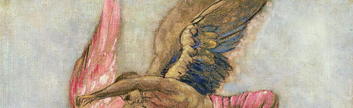
P.S. The image above is MY attempt to sew a Burne-Jones Angel on a Flat Canvas. 20 years later……….!
